Press release
3D PluraView Monitor - Esri ArcGIS Pro certified for 3D stereo visualization
ArcGIS Pro is currently the most modern and advanced desktop GIS product from Esri and is used worldwide for the acquisition, processing and analysis of high-resolution 3D data. Important functionality from photogrammetry, such as the import of aerial images, their triangulation, extraction of a terrain model, orthorectification and stereoscopic data acquisition, are now also integrated into ArcGIS Pro. With the continuous further development of ArcGIS Pro, the boundaries between geographic information systems (GIS) and classic digital photogrammetry are becoming increasingly blurred. This ensures a continuous GIS workflow, including photogrammetric data acquisition, directly in the Esri environment, which contributes to a considerable increase in efficiency. The key element here is the complete integration of all existing and newly captured three-dimensional geometries in ArcGIS Pro, with the built-in ability to display them in true three dimensions on stereoscopic output devices. Esri's ArcGIS Pro software fulfills all requirements for the efficient display and processing of GIS, BIM, LiDAR and photogrammetric geodata in a fully integrated 3D stereo working environment with an outstanding range of functions. The compatibility of ArcGIS Pro with the entire 3D PluraView Monitor product family has now been officially certified by the manufacturer Schneider Digital.Whether professional, thematic maps, complex GIS analyses, geodata management or GIS data acquisition - with the 3D-stereo-capable software application ArcGIS Pro, professional users utilize the world's leading GIS environment from Esri. The Pro version provides GIS professionals with numerous interactive and automated tools for the optimal retrieval and processing of geodata, as well as for capturing and evaluating spatial-topological relationships. Locally stored geoinformation in 2D and 3D format can be compared or synchronized with cloud servers and online data services, for example. Topographical terrain structures and building models with different levels of detail, or so-called 'levels of detail' (LOD), can be extracted and saved in file geodatabases (GDB). ArcGIS Pro also offers a range of powerful tools for managing, processing and analyzing large amounts of data, e.g. large-format aerial images, UAS and satellite images and LiDAR point clouds. Real building facades can be projected onto 3D building geometries using oblique aerial imagery and vehicle-based mobile camera systems, and hybrid 3D terrain models from orthoimagery can be combined with synthetic 3D models for vegetation and building objects.
Large amounts of data - high resolution in 3D stereo with the 3D PluraView monitors
A prerequisite for the stereoscopic display of 3D geodata is a display system that optimally supports ArcGIS Pro users with high-resolution, bright and high-contrast 3D stereo visualization. This perfect visualization solution is provided by the 3D PluraView monitor family from Schneider Digital, which works latency-free with professional graphics cards from NVIDIA and AMD 'plug-and-play'.
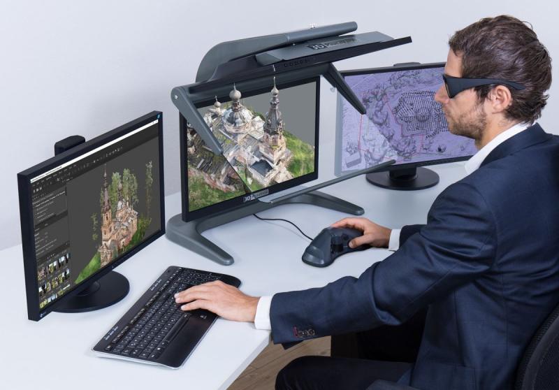
Since no proprietary graphics drivers are required, the 3D PluraView systems are a future-proof solution for displaying geodata in 3D stereo with future LINUX and Microsoft operating systems. The extremely large amounts of data that can be processed with ArcGIS Pro require not only a professional graphics card and a professional workstation, but above all a monitor that can display topographical information and GIS content in the highest 3D stereo quality. Professional analysis and reliable interpretation of data can only be guaranteed with a bright and high-contrast stereoscopic display of 3D content. This is where the US software provider Esri relies on the powerful performance of the passive 3D stereo beamsplitter monitors "3D PluraView" from Schneider Digital. These dual-screen systems have been the de facto industry standard for all stereoscopic software applications for 16 years and are certified for all common 3D-stereo-capable photogrammetry and GIS applications. The flip-up beam splitter mirror also allows the 3D PluraView monitors to be used flexibly as a standard monitor for monoscopic tasks. With screen diagonals of up to 28", the completely flicker-free 3D PluraView monitors deliver highly detailed, stereoscopic 3D visualizations. Thanks to one screen per stereo channel, they offer the full stereo resolution of up to 4K (UHD) with 10-bit color depth in brilliant brightness. With passive polarizing filter technology, they enable fatigue-free, ergonomic working even in daylight in the office, even with several viewers at the same time.
Visualize, capture and edit GIS and BIM models in stereo
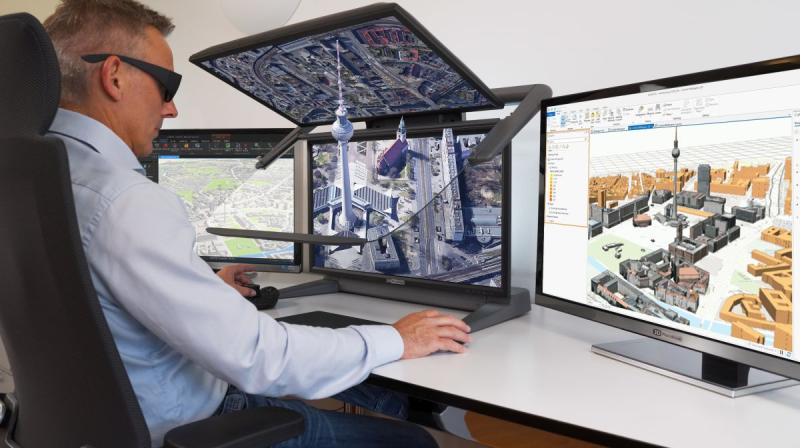
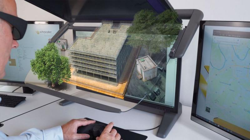
ArcGIS Pro users appreciate the precise, pixel-perfect, stereoscopic image display of Schneider Digital's 3D stereo monitors. The high level of viewing comfort on the flicker-free displays and the intuitive operation facilitate the handling of complex data visualizations, so that tasks can be implemented more efficiently overall and work processes can be accelerated. In combination with ArcGIS Pro, the technology of the 3D PluraView monitors offers the option of loading stereo pairs of aerial images and capturing 3D points, lines or polygons directly as topologically defined GIS elements. Intelligent 3D mesh-based geometries, BIM models and even 3D CAD models can be intuitively edited in a fully integrated 3D stereo environment.
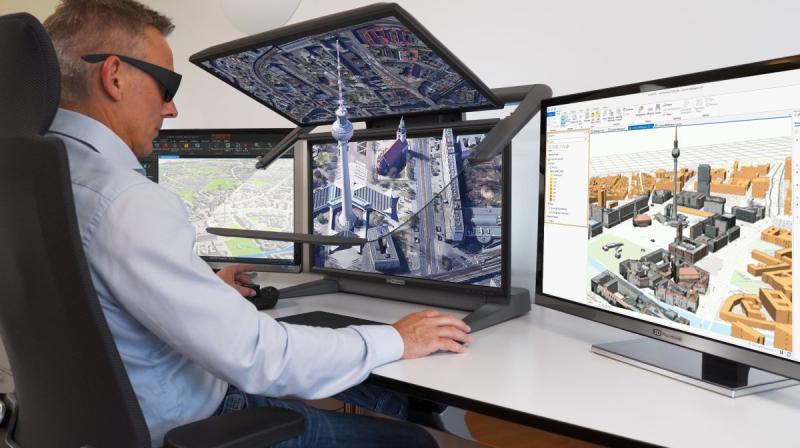
ArcGIS Pro users benefit from compatibility with a wide range of data formats when importing and integrating intelligent 3D models into existing GIS datasets. For subsequent visualization, the 3DConnexion SpaceMouse has proven its worth, making 3D navigation within ArcGIS Pro simple and intuitive. The additional use of a Stealth 3D mouse is recommended if the focus is on the exact measurement and recording of objects, heights and distances. One of the biggest challenges in GIS applications is to quickly load very large amounts of data, e.g. detailed city models, as digital twins and to display them perfectly stereoscopically in 3D. This requires photogrammetry and GIS solutions that are innovative, ergonomic, fast and reliable at the same time. The stereo-capable software application ArcGIS Pro and the Schneider Digital 3D PluraView monitors offer this security through the synergy of two high-end products, which in combination ensure a perfect 3D stereo experience in excellent display quality. The ArcGIS Pro software from Esri fulfills all requirements for efficient stereoscopic work with 3D geodata and has now been officially certified by the manufacturer Schneider Digital for compatibility with the entire 3D PluraView monitor product family. This "duo" becomes the perfect workplace solution with the appropriate 3D input instruments, as well as a high-performance workstation from Schneider Digital customized for the use of ArcGIS Pro.
LEAD Industrie-Marketing GmbH
Hauptstr. 46
83684 Tegernsee
Germany
http://www.lead-industrie-marketing.de
Herr André Gessner
+49 (8022) 91 53 188
+49 (8022) 91 53 189
info@lead-industrie-marketing.de
Schneider Digital is a global full-service solution provider for professional 3D stereo, 4K/8K and VR/AR hardware. Based on its 25 years of industry and product experience and its excellent relationships with leading manufacturers, Schneider Digital offers innovative, sophisticated professional hardware products and customized complete solutions for professional use. Qualified consulting and dedicated after-sales service are the company's own standards.
The Schneider Digital product portfolio includes the right professional hardware solution for the respective requirements in these areas: High Resolution 4K/8K-to multi-display walls. Schneider Digital is the manufacturer of its own Powerwall solution smartVR-Wall and the passive stereo monitor 3D PluraView. Performance workstations and professional graphics cards from AMD and NVIDIA as well as innovative hardware peripherals (tracking, input devices, etc.) round off the range. Many items are in stock. This guarantees fast delivery and project realization.
Schneider Digital is an authorized service distributor of AMD FirePRO/Radeon Pro, PNY/NVIDIA Quadro, 3Dconnexion, Stealth int, Planar and EIZO. Schneider Digital products are primarily used in graphics-intensive computer applications such as CAD/CAM/CAE, FEM, CFD, simulation, GIS, architecture, medicine and research, film, TV, animation and digital imaging.
Further information can be found at www.schneider-digital.com and www.3d-pluraview.com.
This release was published on openPR.
Permanent link to this press release:
Copy
Please set a link in the press area of your homepage to this press release on openPR. openPR disclaims liability for any content contained in this release.
You can edit or delete your press release 3D PluraView Monitor - Esri ArcGIS Pro certified for 3D stereo visualization here
News-ID: 3615489 • Views: …
More Releases from Schneider Digital

Agisoft Metashape Pro and 3D PluraView: Certified 3D stereo photogrammetry at th …
Where conventional surveying reaches its limits today, the 3D photogrammetry application Agisoft Metashape Pro is used, often in combination with so-called "drones" or "Unmanned Aerial Systems" (UAS). As part of the analysis and processing of geodata, Metashape Pro generates detailed, fully textured 3D models with maximum accuracy and detail from digital images. Metashape Pro is not only the ideal tool for processing UAS images, but also for large-format aerial images…

3D PluraView Monitor - certified by Esri ArcGIS Pro for 3D stereo visualization
ArcGIS Pro is currently the most modern and advanced desktop GIS product from Esri and is used worldwide to capture, process and analyze high-resolution 3D data. Essential functions from photogrammetry - such as the import of aerial images, their triangulation, the creation of a terrain model, orthorectification and stereoscopic data acquisition - are now also included in ArcGIS Pro. With the continuous further development of ArcGIS Pro, the boundaries between…

BIM: Planning and viewing in 3D stereo throughout - 3D PluraView and ELITECAD ma …
The perfect combination of 3D planning and stereoscopic display is now possible thanks to the collaboration between Schneider Digital and XEOMETRIC with ELITECAD. Model and design in three dimensions with ELITECAD - and simultaneously experience the results in stereo on the 3D PluraView monitor from Schneider Digital: a convenient and state-of-the-art solution. With its 3D PluraView product range, Schneider Digital has decisively advanced stereoscopic visualization. Through direct integration into ELITECAD…

Stereoscopic monitors for military: shielded and galvanized according to NATO st …
Today's armed forces around the world use digital 3D stereoscopic monitors for image analysis. The analysis of stereoscopic images is considered a key technology, as it provides significantly more interpretable content compared to viewing individual, two-dimensional images from the same source and with identical resolution. In the military sector, modern dual-screen systems based on passive stereo displays are used in geo-information applications - particularly in the fields of photogrammetry, GIS/mapping,…
More Releases for GIS
Geographic Information System (GIS) Software Global Market Report 2024 - Geograp …
"The Business Research Company recently released a comprehensive report on the Global Geographic Information System (GIS) Software Market Size and Trends Analysis with Forecast 2024-2033. This latest market research report offers a wealth of valuable insights and data, including global market size, regional shares, and competitor market share. Additionally, it covers current trends, future opportunities, and essential data for success in the industry.
According to The Business Research Company's, The…
Asset Management GIS World 2024 Coverage
Several public works organizations have made a significant investment into gaining and deploying a geospatial information system (GIS) for tracking their spatial assets, maintaining historical records and sustaining a precise inventory. GIS data delivers invaluable information to these asset management organizations. Whether the user organizations have utilities, roads, parks and recreation, bridges, signals or facilities, a robust integration between asset management and GIS is integral to a long term, successful…
Integration of BIM & GIS
Building information modeling (BIM) and geographic information systems (GIS) are two technologies that have particular applications. GIS has mapping characteristics and geographical databases, while BIM is primarily utilized for building assets as an object-based information model. In challenging and extensive projects, the connecting thread between these two technologies is gaining legitimacy. BIM technologies are typically used in projects related to architecture and civil engineering, while GIS systems are typically used…
Mobile GIS Market is Anticipated to Gain Moderate CAGR by 2027 | ESRI, GIS Cloud
Mobile GIS market research analysis depicts severe economic consequences caused due to the outbreak COVID-19, which affected the entire society and world economy. Present and previous pricing structure made here helps industry players to bring the right products into the market and gain huge returns. Newly entering market player needs to take the help of this Mobile GIS market research when launching any new product. A few of the vital…
GIS Software Market 2025 by Component, Type of GIS Software, Functions, Organiza …
Increasing adoption of GIS for facilities management, integration of GIS with mainstream technologies for business intelligence, and growing demand for GIS software for smart cities development as well as urban planning have fueled the growth of the global GIS Software Market.
For Purchase Inquiry: https://www.alliedmarketresearch.com/purchase-enquiry/5259
The global GIS software market was valued at $3.24 billion in 2017 and is expected to hit $7.86 billion in 2025, registering a CAGR of 11.8% from…
Global Cloud GIS Sales Market Top player: CartoDB , ESRI , Hexagon, GIS Cloud
The report offers a comprehensive evaluation of the market. It does so via in-depth insights, understanding market evolution by tracking historical developments, and analyzing the present scenario and future projections based on optimistic and likely scenarios. Each research report serves as a repository of analysis and information for every facet of the market, including but not limited to: Regional markets, technology developments, types, applications, and the competitive landscape.
Browse Complete…
