Press release
Terrasolid maps the world in 3D - 3D PluraView monitors from Schneider Digital visualize in stereo

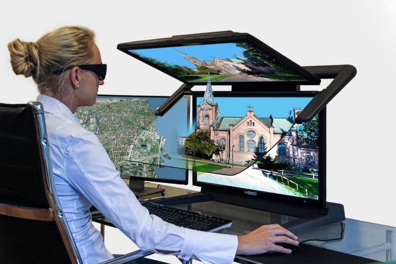
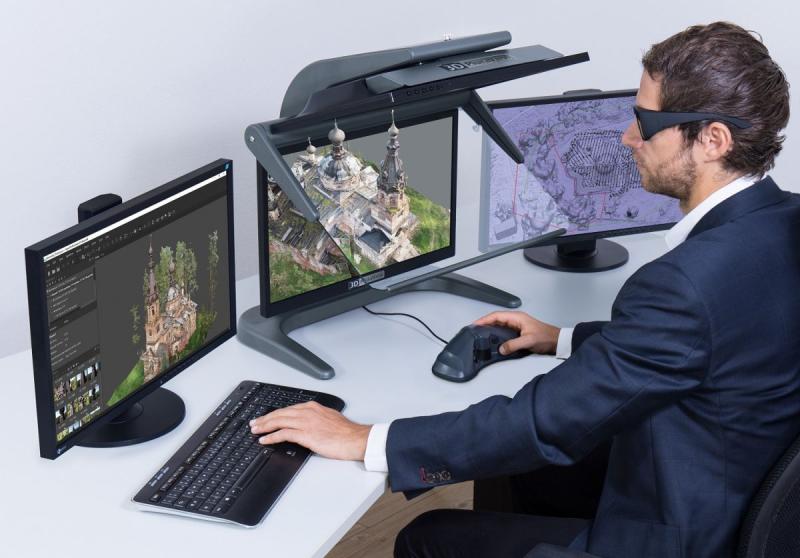
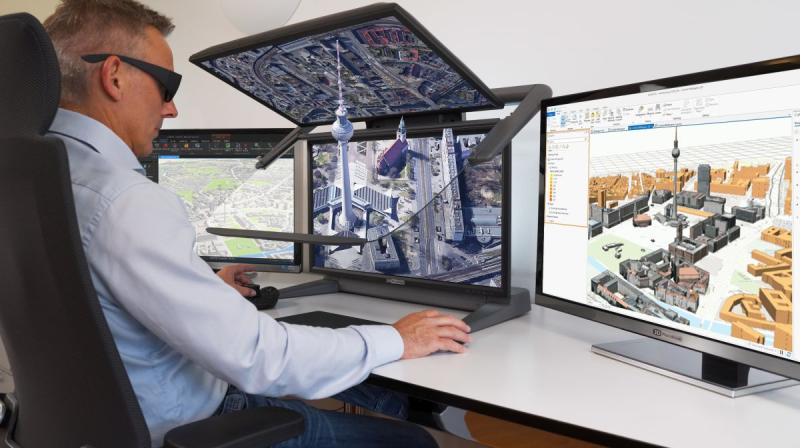
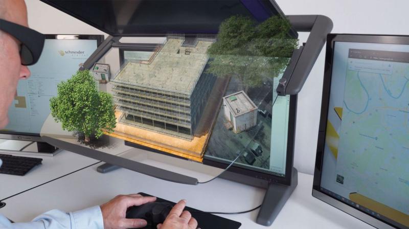
3D stereo-capable application TerraStereo with the 3D PluraView: compatible and officially certified. (© Schneider Digital)
The diversity of LiDAR applications has developed just as rapidly in just a few years: surveying and civil engineers use 3D point clouds for terrain modeling, for the construction and monitoring of bridges, dams and high-voltage lines, as well as for determining the quality of road surfaces with millimeter precision and for the high-precision measurement of railroad tracks and the entire railroad infrastructure. Urban planners receive very precise information about the vegetation in cities, while at the same time precise reference points for building measurements are recorded. Archaeologists use precise and RGB-textured LiDAR data to record and reconstruct important cultural monuments. Recently, after the major fire at Notre-Dame, the medieval church in the center of Paris, the remaining structure was completely surveyed using high-resolution LiDAR instruments. These are just a few examples of the use of LiDAR data, which has been processed for many years with the versatile and constantly evolving tools of the Terrasolid applications.
Use cases are evolving due to the increasing diversity and rapid development of LiDAR data acquisition systems. Very small but precise laser scanners are available for "Unmanned Aerial Systems" (UAS), often referred to as "drones". In larger, single or twin-engine aircraft, very powerful LiDAR instruments are used for higher flight altitudes and for surveying large areas. On the ground (_terrestrial_), LiDAR data acquisition begins with very small scanners that are held in the hand and are therefore ultra-mobile, or - somewhat larger and very precise - laser measuring heads installed on tripods with a range of several hundred meters. These are used in combination with digital cameras, often mounted on vehicle roofs, for fast, mobile LiDAR data acquisition.
Schneider Digital's stereoscopic 3D PluraView monitors with two screens, which are 'plug & play' compatible with Terrasolid's TerraStereo software, provide a visualization experience of these point clouds in the highest 3D stereo quality. Users benefit from flicker-free, pixel-perfect visualization with a resolution of up to 4K per screen and therefore per eye. The 3D PluraView monitors are the perfect visualization solution for comfortable working with high-resolution LiDAR data in all 3D stereo and VR/AR desktop applications. The compatibility of TerraStereo with the 3D PluraView monitor family has now been officially certified by the manufacturer Schneider Digital.
The LiDAR applications from the Finnish software company Terrasolid are the world's leading platform when it comes to processing and visualizing point clouds. As a company, Terrasolid has been successfully established in the geodata market for more than 30 years and has been the global market leader specifically with LiDAR software solutions for more than 20 years. Independent of LiDAR data sources and sensors, Terrasolid offers versatile and powerful tools for editing 3D point clouds, feature extraction, terrain visualization and point cloud visualization. With TerraStereo, even very large point clouds with more than 50 billion points can be realistically visualized in 3D stereo at very high speed with freely selectable color textures.
Visualize, analyse, calculate and extract LiDAR data
TerraStereo is specifically tailored for 3D stereo visualization in every Terrasolid workflow and can be combined with all other Terrasolid software products. The workflow with software products from the Terrasolid family usually starts with TerraScan. TerraScan manages, processes and visualizes all types of point clouds. The application offers various import and project structuring tools for very large amounts of data. With this powerful tool, complex buildings, landscapes as well as road and cable networks can be measured, vectorized and precisely modelled in 3D reliably and with high precision. In combination with additional Terrasolid applications such as TerraModeler, TerraMatch, TerraPhoto, TerraSlave and other products, users have all the tools they need for highly automated processing of LiDAR point clouds and the creation of 3D vector data based on them. TerraStereo offers the possibility to visualize buildings, topographies and entire railroad and tramway infrastructures in 3D stereo. The software application is also used to visualize power lines, visualize corridor analyses, display hazardous objects in 3D stereo and allow efficient visual analysis of the condition of road surfaces for risk assessment.
Terrasolid's software products process LiDAR data from terrestrial and airborne laser scanning systems together with RGB-I image data. Terrasolid is neither limited to specific applications nor to specific laser scanning or camera systems. From calibration, matching and merging of raw data, to the creation of final 3D vector models, orthoimages with TerraPhoto, terrain renderings with and without natural vegetation, the software applications are highly flexible and offer powerful solutions e.g. for surveying and civil engineering, cartography, photogrammetry and surface analysis, but also for archaeology, research and urban development. Terrasolid uses high-performance graphics to convert any point cloud into a clean 3D model or CAD vector elements precisely, quickly and in high quality, saving time and costs and optimizing workflows. The fast data export is a major advantage in smart city and urban planning applications used on desktop, mobile and web platforms, for example.
For the spatial viewing and measurement of 3D models, Terrasolid relies on the detailed and high-contrast 3D stereo display of the passive dual screen systems with beam splitters from Schneider Digital's 3D PluraView series. These high-end displays are the industry standard for all stereo-capable LiDAR, photogrammetry and GIS applications. The color fidelity of RGB textured point clouds is perfectly enhanced with Schneider Digital's powerful and innovative 3D stereo monitors. They ensure a razor-sharp display in real time, are completely flicker-free and can be used "plug & play" for all Terrasolid features, such as 3-axis surveying in 3D space.
Present intelligent point clouds impressively and edit them precisely
The up to 28" 3D PluraView monitors deliver highly detailed, stereoscopic 3D visualizations. Thanks to one monitor per eye, they offer the full resolution of up to 4K with brilliant image brightness. With their optimum ergonomics and passive polarizing filter technology, they ensure fatigue-free working even under normal daylight conditions in the office. Terrasolid users are not the only ones who appreciate the simple handling of the 3D PluraView monitors. This means that 3D models can be easily displayed and measured or edited using a 3D mouse, for example. With the 3D PluraView monitors, Terrasolid users benefit from a sophisticated 3D visualization technology that has been established in the geodata industry for many years.
Schneider Digital is the world's leading manufacturer and distributor of customized hardware solutions for graphics-intensive computer applications and offers professional users in the fields of GIS and photogrammetry complete workstation solutions for the calculation and visualization of large data sets. The powerful performance of its workstations, in combination with innovative high-end displays, has ensured fast and precise workflows in geodata applications for over 25 years. Even the most complex version of 3D modeling becomes an impressive presentation and high-resolution working model with a 3D PluraView monitor. With the high-end displays from Schneider Digital, professional users of the powerful software suite from Terrasolid get a complete package that has been thought through to the highest level. Measuring, capturing, analyzing and visualizing 3D data with these two innovative technologies is not only convenient, but also a real added value in a demanding GIS workflow. This is why Schneider Digital has now officially certified TerraStereo for 3D stereo visualization with its 3D PluraView monitors.
Further information.
LEAD Industrie-Marketing GmbH
Hauptstr. 46
83684 Tegernsee
Germany
http://www.lead-industrie-marketing.de
Herr André Gessner
+49 (8022) 91 53 188
+49 (8022) 91 53 189
info@lead-industrie-marketing.de
Schneider Digital - The Company:
Schneider Digital is a global full-service solution provider for professional 3D stereo, 4K/8K and VR/AR hardware. Based on its 25 years of industry and product experience and its excellent relationships with leading manufacturers, Schneider Digital offers innovative, sophisticated professional hardware products and customized complete solutions for professional use. Qualified consulting and dedicated after-sales service are the company's own standards.
The Schneider Digital product portfolio includes the right professional hardware solution for the respective requirements in these areas: High Resolution 4K/8K-to multi-display walls. Schneider Digital is the manufacturer of its own Powerwall solution smartVR-Wall and the passive stereo monitor 3D PluraView. Performance workstations and professional graphics cards from AMD and NVIDIA as well as innovative hardware peripherals (tracking, input devices, etc.) round off the range. Many items are in stock. This guarantees fast delivery and project realization.
Schneider Digital is an authorized service distributor of AMD FirePRO/Radeon Pro, PNY/NVIDIA Quadro, 3Dconnexion, Stealth int, LEYARD/Planar and EIZO. Schneider Digital products are primarily used in graphics-intensive computer applications such as CAD/CAM/CAE, FEM, CFD, simulation, GIS, architecture, medicine and research, film, TV, animation and digital imaging.
This release was published on openPR.
Permanent link to this press release:
Copy
Please set a link in the press area of your homepage to this press release on openPR. openPR disclaims liability for any content contained in this release.
You can edit or delete your press release Terrasolid maps the world in 3D - 3D PluraView monitors from Schneider Digital visualize in stereo here
News-ID: 3707773 • Views: …
More Releases from Schneider Digital

Agisoft Metashape Pro and 3D PluraView: Certified 3D stereo photogrammetry at th …
Where conventional surveying reaches its limits today, the 3D photogrammetry application Agisoft Metashape Pro is used, often in combination with so-called "drones" or "Unmanned Aerial Systems" (UAS). As part of the analysis and processing of geodata, Metashape Pro generates detailed, fully textured 3D models with maximum accuracy and detail from digital images. Metashape Pro is not only the ideal tool for processing UAS images, but also for large-format aerial images…

3D PluraView Monitor - certified by Esri ArcGIS Pro for 3D stereo visualization
ArcGIS Pro is currently the most modern and advanced desktop GIS product from Esri and is used worldwide to capture, process and analyze high-resolution 3D data. Essential functions from photogrammetry - such as the import of aerial images, their triangulation, the creation of a terrain model, orthorectification and stereoscopic data acquisition - are now also included in ArcGIS Pro. With the continuous further development of ArcGIS Pro, the boundaries between…

BIM: Planning and viewing in 3D stereo throughout - 3D PluraView and ELITECAD ma …
The perfect combination of 3D planning and stereoscopic display is now possible thanks to the collaboration between Schneider Digital and XEOMETRIC with ELITECAD. Model and design in three dimensions with ELITECAD - and simultaneously experience the results in stereo on the 3D PluraView monitor from Schneider Digital: a convenient and state-of-the-art solution. With its 3D PluraView product range, Schneider Digital has decisively advanced stereoscopic visualization. Through direct integration into ELITECAD…

Stereoscopic monitors for military: shielded and galvanized according to NATO st …
Today's armed forces around the world use digital 3D stereoscopic monitors for image analysis. The analysis of stereoscopic images is considered a key technology, as it provides significantly more interpretable content compared to viewing individual, two-dimensional images from the same source and with identical resolution. In the military sector, modern dual-screen systems based on passive stereo displays are used in geo-information applications - particularly in the fields of photogrammetry, GIS/mapping,…
More Releases for Terrasolid
LiDAR Software Market Top Players - Phoenix LiDAR Systems, Terrasolid, GreenVall …
InsightAce Analytic Pvt. Ltd. announces the release of a market assessment report on the "Global LiDAR Software Market Size, Share & Trends Analysis Report By Application (Forestry & Environmental, Survey & Mapping, Automotive, Construction & Infrastructure), Technology Type (Mechanical And Solid States), Product Type (Simulation, Mapping, And Processing Software), And Deployment (Airborne And Terrestrial)- Market Outlook And Industry Analysis 2031"
The global LiDAR Software Market is estimated to reach over…
LiDAR Software Market Top Companies Study - Phoenix LiDAR Systems, Terrasolid, G …
InsightAce Analytic Pvt. Ltd. announces the release of a market assessment report on the "Global LiDAR Software Market Size, Share & Trends Analysis Report By Application (Forestry & Environmental, Survey & Mapping, Automotive, Construction & Infrastructure), Technology Type (Mechanical And Solid States), Product Type (Simulation, Mapping, And Processing Software), And Deployment (Airborne And Terrestrial)- Market Outlook And Industry Analysis 2031"
The global LiDAR Software Market is estimated to reach over…
LiDAR Software Market Top Players - Phoenix LiDAR Systems, Terrasolid, GreenVall …
InsightAce Analytic Pvt. Ltd. announces the release of a market assessment report on the "Global LiDAR Software Market Size, Share & Trends Analysis Report By Application (Forestry & Environmental, Survey & Mapping, Automotive, Construction & Infrastructure), Technology Type (Mechanical And Solid States), Product Type (Simulation, Mapping, And Processing Software), And Deployment (Airborne And Terrestrial)- Market Outlook And Industry Analysis 2031"
The global LiDAR Software Market is estimated to reach over…
3D Point Cloud Processing Software Market 2023 Perception, Extension and Predict …
The market report delivers an all-inclusive analysis of the market structure along with a forecast of the various segments and sub-segments of the 3D Point Cloud Processing Software industry. This wide-ranging market research report acts as a backbone for the success of business in any niche. The 3D Point Cloud Processing Software market survey report has been prepared by conducting market research in a systematic manner. Moreover, the 3D Point…
2023 License Servers Market to Witness Astonishing Growth With| Thales, Altova, …
The License Servers market research report is proficient and top to bottom research by specialists on the current state of the industry. This statistical surveying report gives the most up to date industry information and industry future patterns, enabling you to distinguish the items and end clients driving income development and benefit. It centres around the real drivers and restrictions for the key players and present challenge status with development…
3D Point Cloud Processing Software Market 2023 | Futuristic Technology- Trimble, …
The 3D Point Cloud Processing Software research report studies primary and secondary research in order to analyze the data effectively. The market study further also draws attention to crucial industry factors such as global clients, potential customers, and sellers, which instigates positive company growth. In order to gauge the turning point of the businesses, significant market key players are also enlisted in order to deliver readers with in-depth analysis about…